Like us on Facebook
Follow us on Instagram
 

Rare photos show the consequences of The Great San Francisco Earthquake in 1906

At 5.12 am on April 18, 1906, residents of the city of San Francisco in California woke to severe shaking. The first shock lasted about 20 seconds. There was a brief silence. Then the second wave began. It lasted but 42 seconds, but the death toll was enormous.

The San Francisco earthquake and the fire that followed have gone down in history as one of the deadliest natural disasters in US history, along with the Great Chicago Fire in 1871 and Hurricane Katrina in 2005.

About 3,000 perished, and 80% of the city was leveled.  The Richter scale used to measure earthquakes did not exist in 1906, but estimates range from 7.7 to 7.8. The measure used at the time was the Mercalli Scale, which was XI or Extreme.

The earthquake was felt from Eureka on the north coast of California to the Salinas Valley south of San Francisco Bay. Studies published in the Journal of Geophysical Research indicate extreme movements in the earth’s crust along the 450 kilometer San Andreas Fault.
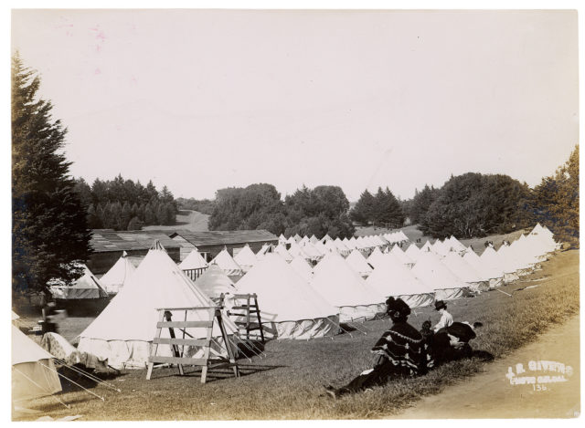
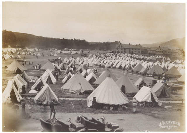
Photograph of a Camp in Golden Gate Park Under Military Control After the 1906 San Francisco Earthquake, 1906
Photograph of a Camp in Golden Gate Park Under Military Control After the 1906 San Francisco Earthquake, 1906 Photo Credit
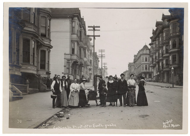
Photograph of a Group Cooking on a Stove in the Street After the 1906 San Francisco Earthquake, 1906
Photograph of a Group Cooking on a Stove in the Street After the 1906 San Francisco Earthquake, 1906 Photo Credit
Photograph of a Military Camp on the Fourth Day After the 1906 San Francisco Earthquake, 1906
Photograph of a Military Camp on the Fourth Day After the 1906 San Francisco Earthquake, 1906 Photo Credit
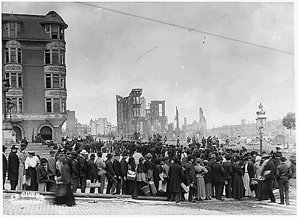
Photograph of a Typical Bread Line in the Early Stages of Relief Distribution After the 1906 San Francisco Earthquake, 1906
Photograph of a Typical Bread Line in the Early Stages of Relief Distribution After the 1906 San Francisco Earthquake, 1906 Photo Credit
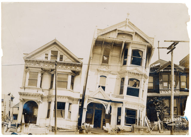
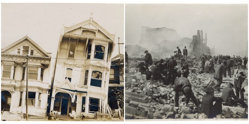
Photograph of the Effect of Earthquake on Houses Built on Loose or Made Ground After the 1906 San Francisco Earthquake, 1906
Photograph of the Effect of Earthquake on Houses Built on Loose or Made Ground After the 1906 San Francisco Earthquake, 1906 Photo Credit
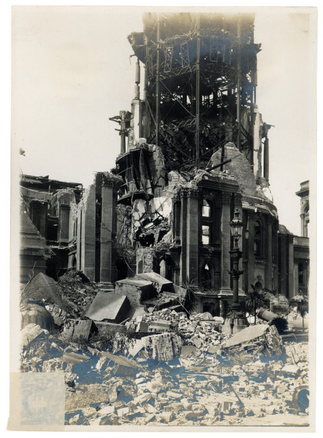
Photograph of the Ruined Tower of the City Hall Damaged by the 1906 San Francisco Earthquake
Photograph of the Ruined Tower of the City Hall Damaged by the 1906 San Francisco Earthquake Photo Credit
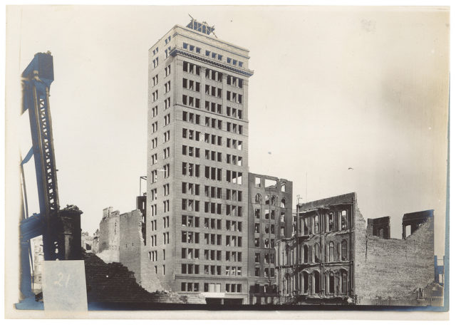
Photograph of the West Front of the New Chronicle Building Showing Damage by the San Francisco Earthquake of 1906
Photograph of the West Front of the New Chronicle Building Showing Damage by the San Francisco Earthquake of 1906  Photo Credit
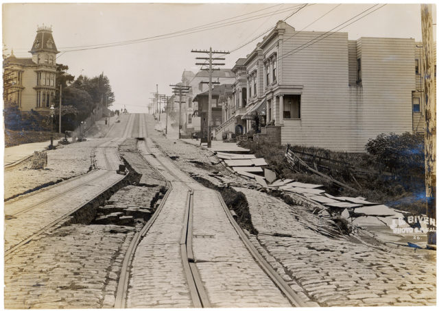
Union Street car line – showing displacement of made ground
Union Street car line – showing displacement of made ground  Photo Credit
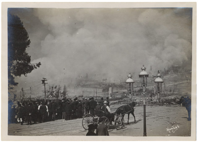
Fire Partially Under Control After the 1906 San Francisco Earthquake, 1906
Fire Partially Under Control After the 1906 San Francisco Earthquake, 1906  Photo Credit
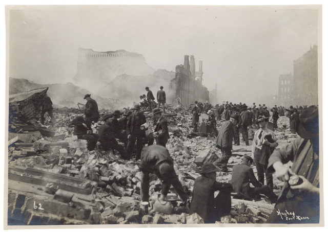
Photograph of Souvenir Hunters After the 1906 San Francisco Earthquake, 1906
Photograph of Souvenir Hunters After the 1906 San Francisco Earthquake, 1906 Photo Credit

The epicenter of the quake was some 3.2 kilometres offshore from San Francisco. Tremors were felt along the coast from Oregon to Los Angeles and as far inland as Nevada.

Many died in the earthquake itself, but others perished in the fires that followed. Underground gas pipes were twisted and broken, and fallen electric clines ignited the gas.

The fires lasted several days. One hundred and eighty-nine deaths were reported in the rest of the San Francisco Bay areas as well. The cities of Santa Rosa and San Jose were severely damaged and in Monterey County the Salinas River changed direction, flowing to sea north of Marina, whereas it had done so at Monterey Bay 9.6 kilometers away. The earthquake left up to 300,000 people homeless.

Those who could leave fled to Oakland or Berkeley. Makeshift shelters dotted the beaches and parks of San Francisco for two years or more.Minor tremors continued for decades afterward. The San Andreas Fault has been more unstable since 1906.

Love historic buildings? Here is another story from us:“Roman Lighthouse” at Dover Castle is the oldest building in England

But rather than being seen as warnings of another major quake, these tremors seem to be seasonal and connected to sediment loads deposited over the fault. This appears to be due to hydraulic mining undertaken during the California Gold Rush in the 1850s.
Neil Patrick

Neil Patrick is one of the authors writing for The Vintage News