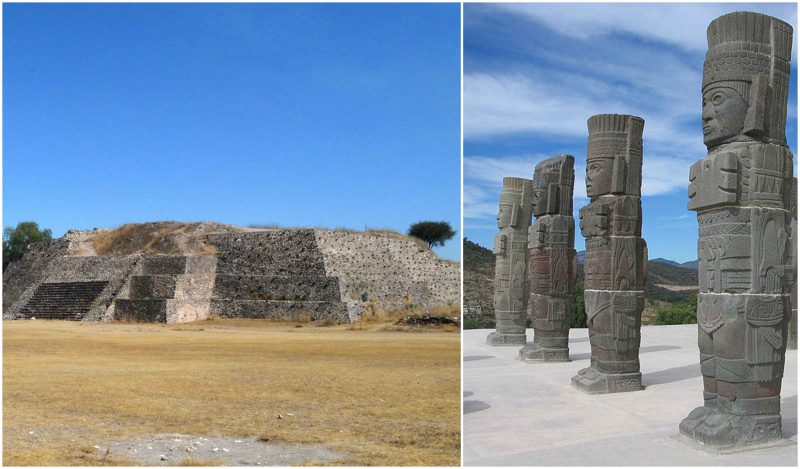
Between the fall of Teotihuacan and the rise of Tenochtitlan, there was another capital of the Toltec Empire: Tula. Unlike the former two, Tula hasn’t been studied in detail, so there are controversies about the power of its influence, its political system, and its relations with other Mesoamerican cities, particularly with Chichen Itza.
Tula is located northwest of modern-day Mexico City, in Tula de Allende, in the Tula Valley
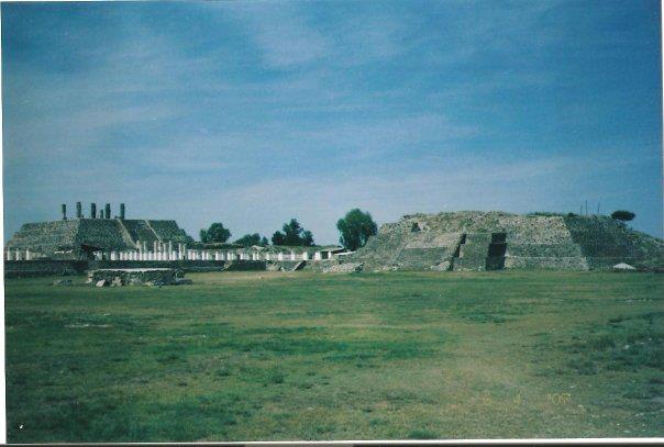
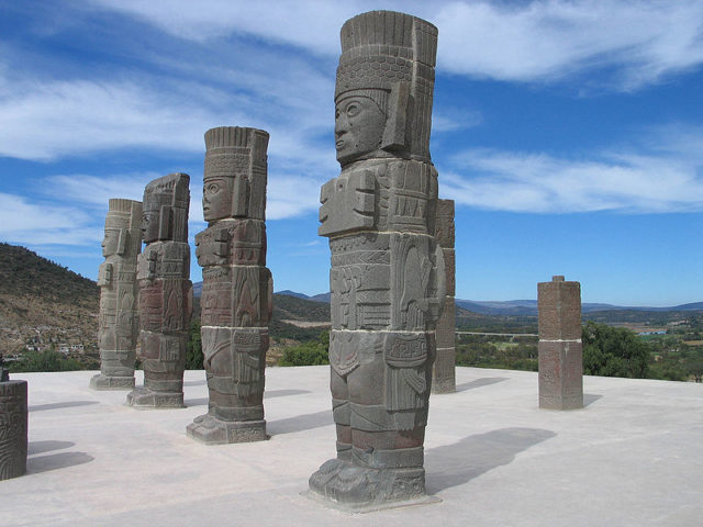
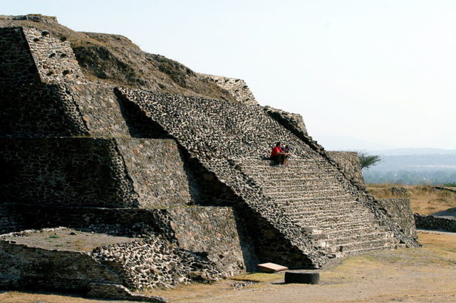
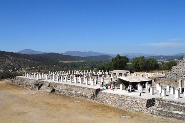
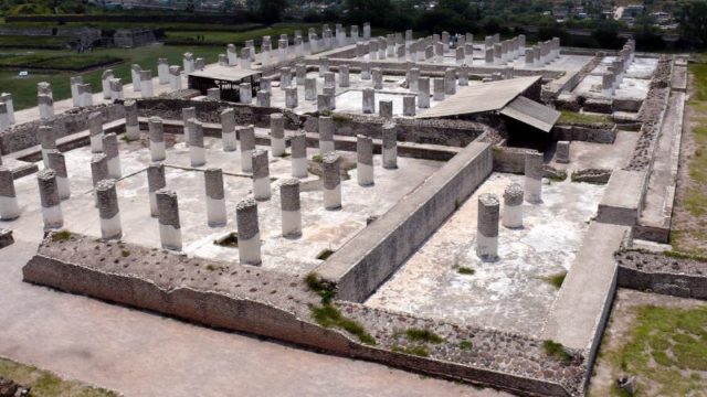
Today a Mesoamerican archaeological location, Tula consists of the main ceremonial site Tula Grande, the Jorge R. Acosta museum, the Guadalupe Mastache Orientation Center, and the remains of Tula Chico, an earlier settlement. The main attraction at the site is the pyramid of Quetzalcoatl. On top of the pyramid, there are four 13-foot-high basalt monuments that are carved in the shape of Toltec warriors.
The site is related to Quetzalcoatl, the feathered serpent god, who was widely worshiped across Central America at the time the Spanish arrived. It is likely that the Tula civilization had a kind of hieroglyphic writing system, but there is no evidence to support this claim, except for an occasional glyph on a structure.
The name Tula is derived from “Tollan Xicocotitlan,” which is a phrase in Nahuatl, meaning “near the cattails.” The Aztecs later used the term Tollan to refer to urban centers, indicating other sites such as Tenochtitlan, Cholula, and Teotihuacan. The term “Toltecs,” which was used for the inhabitants of Tula, was later used to indicate an urban person, a skilled worker, or an artisan. The remains of the ancient city of Tula are located in the Tula River Valley, in the region that is called “land of the gods” by the indigenous people. The area has an elevation of between 6,562 and 7,218 feet (2000 and 2200 meters) and a semi-arid climate.
According to archaeological records, the earliest well-defined settlements in the area appeared before 400 BCE. Tula was most likely inhabited by people of different ethnic backgrounds among which were the Nonoalcas from the south and the Chichimecas from the north. It started as a small urban settlement called Tula Chico, which means “Small Tula.” It had smaller buildings than those of other Epiclassic sites, and it probably didn’t have any significant political and economic role at the time. Tula Chico developed between 650 and 750 AD. At its height, the city had a population of 19,000–27,000. By 850, Tula Chico was abandoned and Tula Grande began to develop.
It had smaller buildings than those of other Epiclassic sites, and it probably didn’t have any significant political and economic role at the time. Tula Chico developed between 650 and 750 AD. At its height, the city had a population of 19,000 to 27,000. By 850, Tula Chico was abandoned and Tula Grande began to develop.
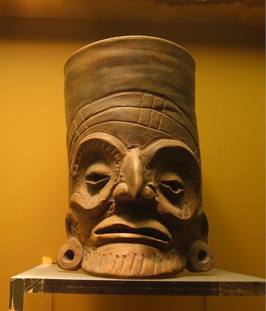
The decline of Teotihuacan had an impact on many nearby areas, especially on Tula. During this time, Tula’s development is visible in the ceramics that were influenced by different techniques and styles. Also, the settlement patterns changed with people starting their households generally on hilltops and high hillsides. The influence that came from the west and north was also visible in Tula’s architecture and pottery. As Tula Grande developed, it got to the stage where it couldn’t be compared to anything contemporary with it but yet, it never outgrew Teotihuacan.
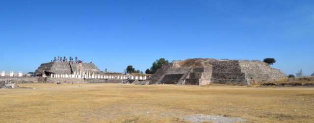
At its height, Tula Grande had a population of approximately 60,000 with another 20,000–25,000 in the surrounding 386 square miles, dominated by the ceremonial center. The region around Tula was an important trade route, and there were also obsidian mines nearby. The city also had a defensive fortification against the Chichimecas at Toluquilla and Las Ranas. On the top of the Tula social hierarchy were the elite ruling class, followed by a craftsmen class, a merchant class, and a large number of farm workers. Most of the farm workers lived in the area around Tula while the rest were near its center.
During excavations in the area, evidence was found for the cultivation of squash, maguey, corn, beans, amaranth, chili peppers, and also some wild plants such as cactus fruit and mesquite. The most important crop was the irrigated corn, cultivated on 3,000–10,000 hectares.
Around the year 1000, the drying of the climate and the leaching of soil forced the Chichimecas to move south from their drying homelands. This caused an ethnic strife that resulted in the collapse of Tula. It appears that many buildings were abandoned by 1150. It is not certain what year exactly the ceremonial center was abandoned, but it was burned during the 12th century, and the pyramids were destroyed. However, the site continued to be occupied until the end of the Mesoamerican period and later during the colonial period.
Bernardino de Sahagún, a Franciscan friar and a pioneering ethnographer, has written that at the time of the colonization of New Spain, today Mexico, there were many potters, feather workers, masons, stonecutters, scribes, and many other craftspeople found in Tula. However, the function of Tula and the city at all is not well understood as there is very little written about it. There are several misconceptions and claims about the site, but since there is not enough archaeological and ethnographic evidence, so nothing can be taken with certainty.
However, the city remained an important part of the later history of the Aztec Empire, although most of the stories related to the city are heavy in myth. In many of these stories, Tula is portrayed as a paradise where the people master the sciences and arts.
Related story from us: Countries that ceased to exist in the 20th century
In others, Tula is falling apart because of some conflicts, and Quetzalcoatl is represented as its last ruler. Most of the history of the Toltecs was lost when Itzcoatl, the fourth king of Tenochtitlan, founded the Aztec Empire. The city planning of Tula was used in the building of some Aztec urban centers.
