“The extraordinary greatness of the Roman Empire manifests itself above all in three things: the aqueducts, the paved roads, and the construction of the drains.”
Dionysius of Halicarnassus, Ant. Rom. 3.67.5
There’s a reason why people say “all roads lead to Rome.” Roman roads were the heart of the vast ancient empire, continually built from about 300 BC all through the centuries of expansion and consolidation of the Roman Empire.
Like the veins that pump blood to the heart to keep the human machinery alive, the Roman roads kept the empire going. Extending through the seemingly endless territories that the empire held, the entire network started in Rome.
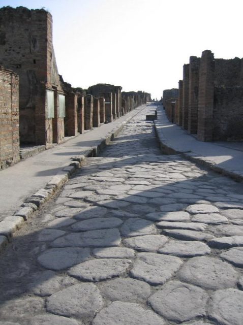
Thanks to this highly developed infrastructure, Roman armies, officials, and civilians were able to easily reach their destinations or trade goods and resources. From small local roads to wider ones, the highways of the ancient time, many of the roads were stone-paved. They linked major cities, military bases, or other sites of strategic importance. The roads were also flanked by footpaths, enabling horseback riders to easily use them, and had drainage ditches.
The Antonine Itinerary amusingly depicts the Roman road system throughout the reign of Augustus. It reads, “There is hardly a district to which we might expect a Roman official to be sent, on service either civil or military, where we do not find roads.” With a few exceptions, such as territories north of Hadrian’s Wall in Britain, and a few provinces east of the Euphrates, the entire empire embraced the so-called “itinera.”
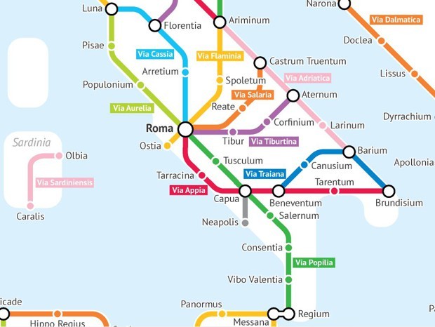
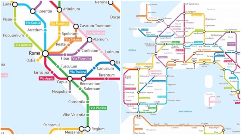
Now, can you imagine this ancient network of roads presented as a modern subway map, the kind we see today in metro stations? Sasha Turbetskoy, a self-acclaimed “geography and data nerd,” has taken on such a challenge and produced smart-looking maps showing the Roman roads as subway lines.
As a 20-year-old major in statistics at the University of Chicago, Trubetskoy says that “there’s something alluring about Rome’s ability to carve out such a huge and advanced empire, with a legacy that lasts today.”
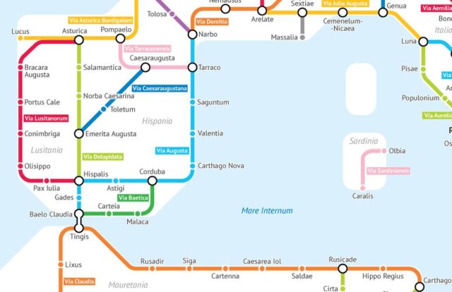
The data Trubetskoy needed for producing the map was sourced from Stanford’s ORBIS model, the Pelagios Project, and the Antonine Itinerary quoted above. Trubetskoy explains that the map only features the major roads, as it is impossible to include the complete road network. Naturally, population centers and capitals of the provinces have been given priority here, and the creator has also taken the liberty of naming a few of the roads that existed without a name. Some roads that originally overlap one another are combined into one, too.
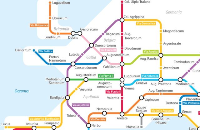
In the heyday of the Roman Empire, the road network reportedly extended over 250,000 miles. Approximately 50,000 miles of road were stone-paved in total. In Gaul alone, some 13,000 miles of roadways were enhanced, and in Britain at least 2,500 miles. It is the big numbers that count here, but Turbetskoy has successfully packed the perplexed network into a neat and easily understandable subway map.
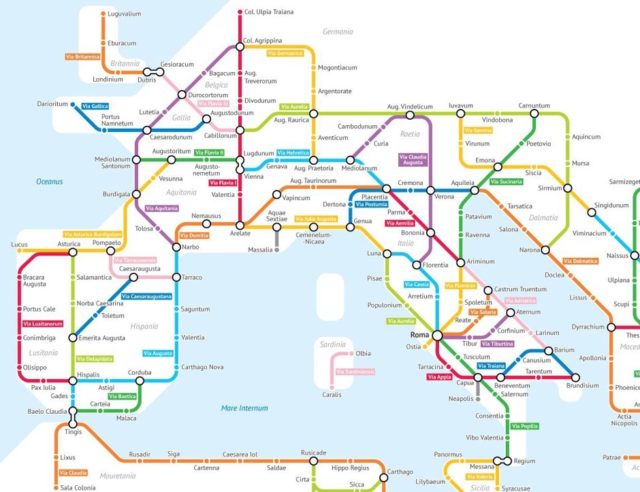
Many tracks have survived the long centuries, and nowadays, some are overlaid by modern roads. The gigantic numbers should come as no surprise, though. Rome was a very efficient empire and construction and production were among its strengths. As most historians agree, Rome strategically invested in infrastructure and technological inventions in order to aid its army and ambition in creating and maintaining such a vast empire.
The maps can also be checked out in large versions, clicking here. For a small fee, Turbetskoy can also send high-resolution, printable PDF versions.
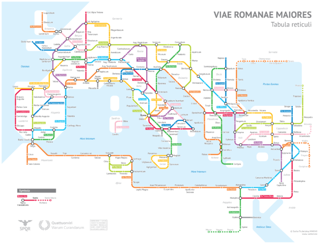
Turbetskoy’s maps provide us with a glimpse of the Roman Empire in 125 AD.
It is up to our imagination to realize how much manpower and effort were needed to create such an overwhelming transit network, some parts of which exist in good condition today.
