Not even two miles south of Jervis Bay, and fairly close to Jervis Bay Village, there once stood a lighthouse. Initially constructed in 1860, this lighthouse stood for three decades before it was leveled to the ground.
A proposal for a lighthouse on this spot was given in 1856 and accepted not long after. The construction of the lighthouse began without permission of the main controlling board of the day.
In the early stages of construction, a controversy about this lighthouse arose. The Pilots Board started to receive numerous complaints as well as reports that investigated the angle of light and said that the proposed location and the actual building site were five miles apart.
The Pilots Board made an investigation and what they found was shocking. The map that was used to select the site had been drawn incorrectly. “The original map and marking of the proposed lighthouse location were so inaccurate that later there were doubts as to whether the light had been erected on the selected site,” writes lighthouses.org.au.
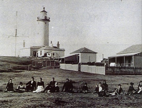
But despite everything, the lighthouse was erected and finalized on October 1st, 1860. When the light was installed, it became apparent that the ships approaching Jarvis Bay from the north side could not see the light beacon.
Those approaching from the south were in a somewhat similar position, for they could barely see the lighthouse. Upon inspecting it, it was discovered that the contractor built the lighthouse two and a half miles north of where the lighthouse was supposed to have been.
The reason was that this location was close to the quarry. For this, the New South Wales Government was notified and a committee was chosen to look deeper into this matter.
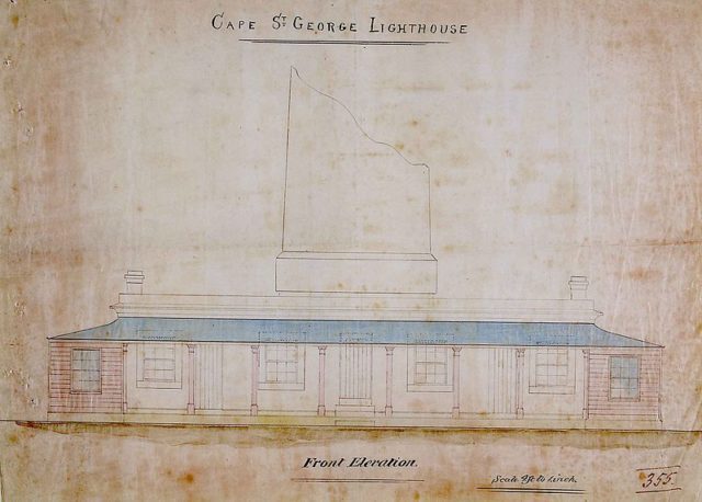
The committee found that the location was chosen without inspecting the site and solely relying on maps of dubious character. But nonetheless the lighthouse remained and as a direct result, from 1864 to 1893, this lighthouse was responsible for 23 shipwrecks. All of the accidents happened on the New South Wales’s south coast, a location that is fairly close to Jervis Bay.
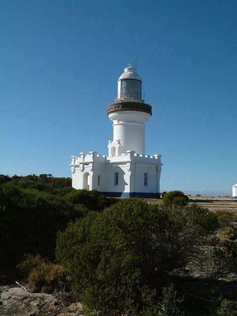
It was 1899 when it was decided that the lighthouse needed to be replaced. And for this purpose, a new lighthouse was erected on the southern tip of the northern headland named Beecroft Peninsula. They named this lighthouse “Point Perpendicular Light.”
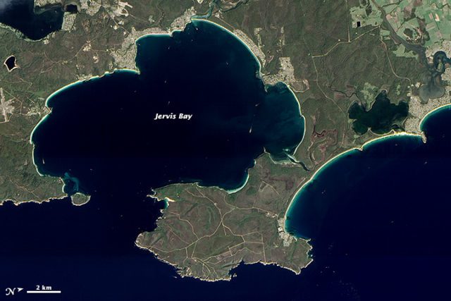
This location proved to be more than perfect and the lighthouse itself was used for years. The light from the Cape St. George Lighthouse was eventually dismantled and was installed in Crookhaven Heads Light, a lighthouse that was erected in 1904 north of the town of Culburra; the Crookhaven Heads Light today stands abandoned and is a favorite target for vandals.
Once the new Point Perpendicular Light was put to use, it became clear that having two lighthouses standing in the same vicinity is confusing especially during daylight.
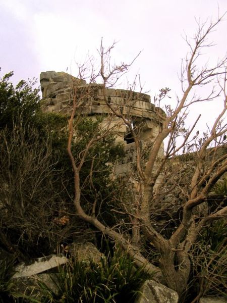
Having no real use for the Cape St George Lighthouse, the Royal Australian Navy decided to use this decommissioned lighthouse as a target during military drills. As a result, the lighthouse was destroyed.
On October 21st, 1980, what was left of the lighthouse was listed on the Register of the National Estate as no longer functioning.
It was June 22nd, 2004, when the ruins of the lighthouse became part of the Commonwealth Heritage List. “The fact that the lighthouse was incorrectly sited, the subsequent abandonment of the place, and its reduction to a ruin add to its historical and landmark significance,” writes environment.gov.au.
Throughout its existence, the lighthouse was the site of two tragedies; the first accident involved two girls by the name of Kate Gibson and Harriet Parker. Kate was the daughter of the chief lighthouse keeper and also responsible for the death of Harriet. According to the investigators, Kate accidentally shot Harriet in 1887.
The second accident happened when the lighthouse keeper by the name of Edward Bailey drowned in 1895. He left behind his wife and 11 children.
