We are determined to look for the remnants of old civilizations on land, yet some of them lurk hidden beneath the surface of oceans, seas, and as one example from China vividly illustrates…submerged in a man-made lake.
Here’s a review of four of the world’s lost underwater cities. Some of them are certain to evoke a feeling something nightmarish was happening as they sank.
Yonaguni-Jima — Japan’s underwater pyramid
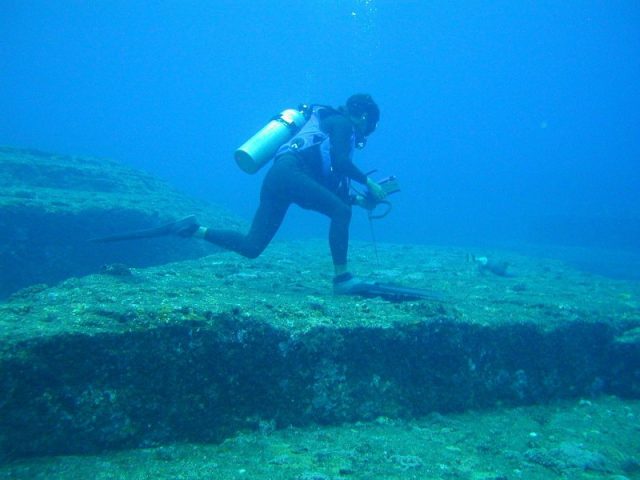
Debates are ongoing whether the strange Yonaguni Monument, also called the Yonaguni Island Submarine Ruins, is the work of nature or an ancient human-constructed wonder.
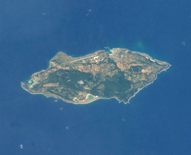
The submerged structures scattered on the seafloor are located off the Japanese coast, not too far from Taiwan. The site was first identified in 1986 thanks to divers searching the area for hammerhead sharks.
The most prominent feature of the ruins is a rectangular rock that rises about 90 feet from the seabed and measures 490 feet by 130 feet at the base.
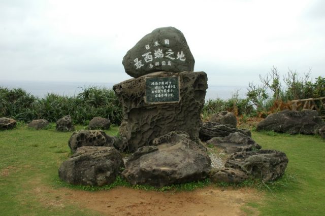
One group of experts believes humans created the structures many millennia back, perhaps during the last Ice Age when the piece of land was still above the water.
Marine geologist Professor Emeritus Masaaki Kimura, from the University of the Ryukyus, believes carvings found at Yonaguni are similar to the Kaida glyphs, pictograms that were used by natives of the Yaeyama Islands in southwestern Japan.
According to Kimura, distinguishable in the ruins are the pyramid, as well as fort structures, monuments, and roads. He postulates that these might be the remnants of Mu — a lost continent whose very existence is disputed, just like Europe’s Atlantis.
Opponents to this theory attribute the creation of the ruins to strong ocean currents and active tectonic plates, although this does not explain the presence at the site of pottery and other stone artifacts believed to be older than 4 million years. It might be that the monument and the artifacts are unrelated.
Whichever the case, Yonaguni has still not been acknowledged as a protected heritage area by Japanese officials.
Rungholt, the sunken city of the North Sea
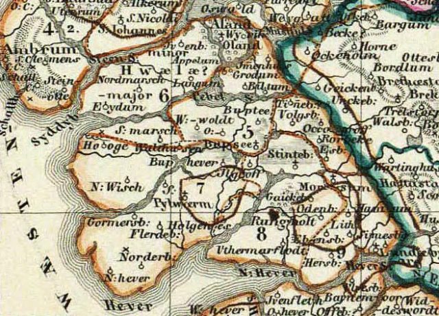
Another proof that nature is always at work, relentlessly reshaping the face of its continents and seas, is the Island of Strand.
This once-thriving island on the North Sea coast vanished after an unprecedented windstorm on a grim and cold day in January 1632.
The violent event is remembered as the Grote Mandrenke, or the Second Saint Marcellus’ flood, and it battered the coasts of the British Isles, the Netherlands, Denmark, and Germany.
The impact of the storm was disastrous. At least 25,000 people drowned in the storm surge, and many coastal towns and villages were lost, including Rungholt — the only settlement on the Island of Strand.
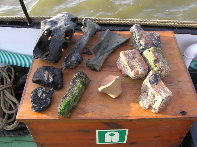
After the storm, the island was reduced to a few insignificant islets. The exact location of Rungholt was never pinned down. Divers have so far been able to retrieve artifacts believed to be linked with the Rungholt underwater ruins.
At the time Rungholt was a thriving North Sea harbor, the home of 3,000 people who relied on maritime trade and fishing. About 5,000 homes were lost as the city disappeared in the waters.
China’s artificially submerged city
China is well noted today for its bizarre copycat architecture, a trend known as duplitecture. The country has its own version of the Eiffel Tower, its own Rockefeller Center, and its own Tower Bridge among its rich array of landmark copies.
Half a century ago, before any of these structures were built up, the country opted for yet another bizarre architectural decision: to flood one of its own cities on purpose.
The name of the city was Shi Cheng and was once a thriving administrative and political center in the eastern province of Zhejiang. The city was founded by the 2nd century AD, and despite its age-old origin, in 1959 Shi Cheng was sacrificed in order to build a hydroelectric power station.
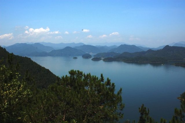
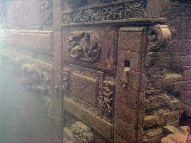
Little by little, Shi Cheng was flooded by an artificial body of water, now called Qiandao Lake. Decades later when divers returned to the site in order to see if there is anything left of the city, they were astonished to stumble upon city structures in fairly pristine condition.
Wondrous white temples, public buildings, and houses were remarkably preserved to the smallest detail. Sculptures and intricate reliefs can be spotted during diving, too. All structures of the city now lurk at in between 85 and 130 feet below the surface of the artificial freshwater lake.
Shi Sheng is also known as the Lion City, after the Lion Mountains which cast their shadow over the area. The site has become a popular tourist destination in recent years.
Jamaica’s Port Royal — the sunken haven of pirates
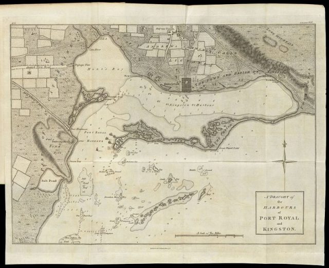
Billed as “the most wicked and sinful city in the world,” Port Royal was where pirates came to party back in the 17th century. The city was found on Jamaica’s southeast coast and for a short while it was even governed by one of the most infamous pirates of all times — Henry Morgan.
Under English administration, Port Royal relied on the slave trade market, prostitution, and raids carried out by pirates on enemy Spanish vessels. It grew prominently in size and population.
The blasphemy and vice came to an end early in the morning of June 7, 1692. A magnitude 7.5 earthquake rocked the island’ foundations and battered the city of Port Royal.
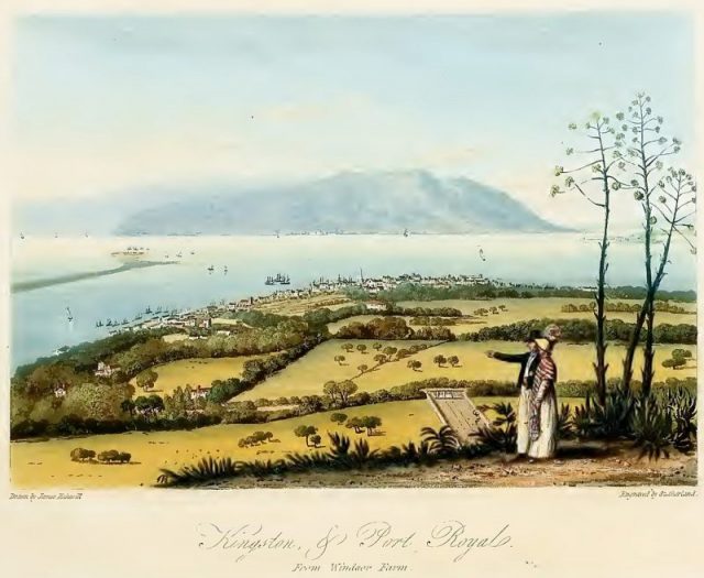
Accounts of the tragedy say that the earth opened up and swallowed everyone and everything standing on the sandy plateau where the city was located. What little survived the earthquake was claimed by a huge tsunami triggered by the violent shake.
In the aftermath of the tragedy, most of the city, its forts and harbors, vanished underwater, along with the bodies of at least 2,000 people. Most remnants were gone at the bottom of the ocean.
Read another story from: The Mysterious Underwater Land Mass Known as the ‘British Atlantis’
Until a few decades ago, boats sailing above where the city was laid to rest in the waters were able to see traces of it, around 40 feet below the surface. It must have been an eerie experience.
