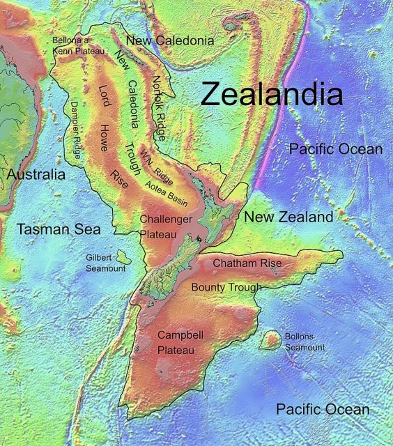
Every school child learns that the Earth has seven continents: Asia, Africa, North America, South America, Antarctica, Europe, and Australia/Oceania. What most people don’t know is that there is another continent called Zealandia.
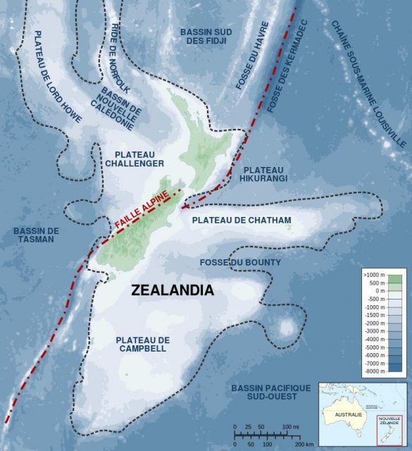
The area wraps around New Zealand, and the continental crust covers 1.89 million square miles of unfragmented land which gives it all of the qualifications for a continent.
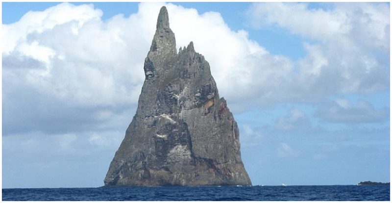
The only catch is that most of it is underwater. Just 6 percent of Zealandia is above water, which includes New Zealand and New Caledonia. In the 1990s, a group of scientists, including geophysicists and geologists, began studying the area and reported their findings in an article for The Geological Society of America in December 2016.
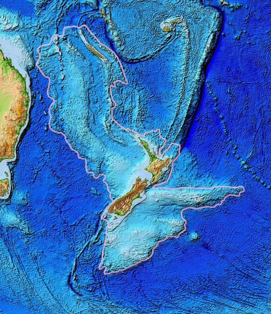
Their conclusion was as follows: “Based on various lines of geological and geophysical evidence, particularly those accumulated in the last two decades, we argue that Zealandia is not a collection of partly submerged continental fragments but is a coherent 4.9 Mkm2 continent.
Currently used conventions and definitions of continental crust, continents and microcontinents require no modification to accommodate Zealandia.” As a follow-up, in September 2017, a research team of 32 scientists went to Tasmania to drill into the submerged parts of the continent.
In six sites, 8,202 feet of sediment cores were brought up to study the climate and geography of the past. Gerald Dickens of Rice University claims that the different types of small fossils discovered indicate that Zealandia was closer to sea level in the past.
Analysis of the cores is still underway, according to the National Science Foundation.“If you could pull the plug on the world’s oceans, then Zealandia would probably long ago have been recognized as a continent,” remarked Nick Mortimer from GNS Science, according to National Geographic. He noted that the continent was first written about in 1995, and that researchers are still collecting data.
In fact, the name was coined in 1995 by Bruce Luyendyk, a geophysicist at the University of California at Santa Barbara. Scientists believe Zealandia separated from the Australian continent anywhere from 60 to 85 million years ago.
Related Video: 6 Mysterious Islands From Around The World
Isostatic balance and thermal relaxation of the thinner continental crust of Zealandia and West Antarctica was the cause of the submergence, but the continent has undergone many changes over billions of years, most of it ending up about two thirds of a mile under the water. Gerald Dickens of Rice University in Houston, Texas says that the formation of the Ring of Fire in the Pacific Ocean damaged the seabed of Zealandia.
The Ring of Fire is a geological feature containing more than 450 volcanos, both dormant and active. It runs north from Zealandia over Southeast Asia, up through Japan then across to Alaska and down the western coast of North, Central, and South America. It includes Mt. Fuji, Krakatau, Mt. Rainier, Mt. St. Helens, Mt. Kilauea, and Mt. Pelee just to name a few. Most were created because of subduction when heavier tectonic plates slid under lighter ones. According to EarthSky, about 90 percent of the most powerful volcanoes that have erupted since 1850 are in the Ring of Fire.
![Map showing bathymetry [depth] of the seafloor around New Zealand, including most of Zealandia. The boundaries of countries’ exclusive economic zones and New Zealand’s continental shelf are also shown. Photo by Dennis P. Gordon, Jennifer Beaumont, Alison MacDiarmid, Donald A. Robertson, Shane T. Ahyong CC BY 2.5](https://www.thevintagenews.com/wp-content/uploads/sites/65/2019/04/lossy-page1-800px-zealandia_eezs-tif-481x640.jpg)
Related Article: When did Humans First Inhabit Australia? New Findings Suggest a Much Earlier Date
Of course, finding a “lost” continent has fueled the imagination of some who wonder if this is the location of the lost city of Atlantis written about by Plato in about 360 BC. However Jamie Allan, program director at the National Science Foundation’s division of Ocean Sciences, assures us, in PJ Media, that there is no chance of that because Zealandia is not only in the wrong place, but sank so long ago it could not possibly have been recorded.
