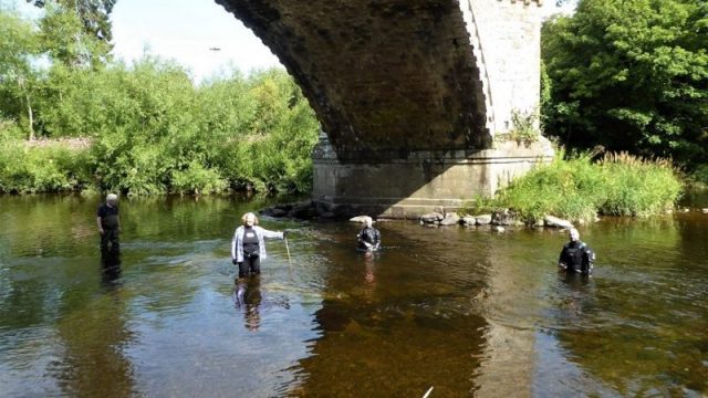
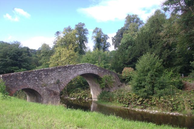
Medieval Bridge : In 2018 a member of the Ancrum and District Heritage Society near Ancrum, Scotland was perusing a local document from 1647 and discovered a mention of a bridge that at one time spanned the River Teviot.
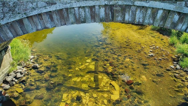
The remains of the bridge were found underwater in the river using drones and aerial photography. After two years of study, Wessex archeologists, Dendrochronicle, a group which specializes in timber and volunteer members of the Ancrum and District Heritage Society have determined that the bridge dates back to the 1300s and stood for over four hundred years.

According to heraldscotland.com, famous historical figures who used the bridge would have been King David II who ruled from 1329 to 1371 and may have ordered the construction of the bridge to hasten the route from Edinburgh to Jedburgh and the Borders.
Mary, Queen of Scots crossed in 1566 and a young James V traveled over the bridge in 1526. In 1545 Henry VIII’s Rough Wooing War began, a plan devised by the king to marry his son Edward to Mary Queen of Scots and promote the Protestant religion in Scotland as well as ownership of a piece of land that was claimed by both Scotland and England.
The English army was attacked and defeated by an army of Scots in the Battle of Ancrum Moor and the Marquis of Montrose used the crossing on his way to his own defeat at the Battle of Philiphaugh near Selkirk in 1645.
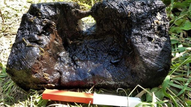
According to Coralie Mills of Dendrochronicle, the bridge was at one time a wooden multi arch design made from oak that may have originated in Jedforest, about three miles away. The foundations were placed thirty two feet apart and the wood was from the 1300s according to radiocarbon dating.
Geoff Parkhouse of ADHS remarked, “Ancrum Old Bridge now has a 14th century date. In Scotland there is not a standing bridge that is earlier than the 15th century.
In those times, during flood or highwater, the Ancrum Bridge may have been the only place to cross the Teviot between Hawick and Berwick, making it one of the most important structures in medieval Scotland.” He likened the bridge to a social spine for the local farmers and tradesmen.

The bridge was also important in trade, according to smithsonianmag.com. Abbeys and castles were made closer by the construction of the span and were able to trade wool and collect taxes. Dr. Robert MacKintosh of Wessex Archaeology Coastal & Marine claimed that, “The results are really exciting.
In addition to the surprisingly early date, it seems the foundations were built using branders, a wooden frame laid on the riverbed upon which the courses of stone were placed. This is the first-time branders have been found in an archaeological context in Scotland.”

By 1698 the bridge was in such a state of disrepair it was no longer used. The townspeople urged the authorities to fix the bridge but their requests were ignored only to have more damage done by a flood a few years later.
A toll bridge was built on the site in 1784 and replaced in 1939. Excavations are still being conducted and as with most archeological sites it is exposed meaning looters and treasure seekers are always a threat.
Scotland.org tells us the Scottish Borders is an area of eastern Scotland and is called such as it sits on the border of Scotland and England.
It is one of thirty two council areas of Scotland and borders on the north by Edinburgh. The River Tweed runs east to west through the area. The largest town is Galashiels with a population of almost fifteen thousand residents and Earlston which is the home to almost two thousand and a total of one hundred fourteen thousand as of the March 2011 census.
Another Article From Us: Hundreds Of Pure Gold Roman Coins Found in Italy
Want articles by The Vintage News delivered straight to your inbox? Subscribe to our weekly newsletter!
For centuries the textiles industry is one of the sources for wool Tartan plaid as well as cashmere and wool supplied to famous makers such as Chanel and Dior. Agriculture and livestock are also important in the area boasting the best lamb and beef in all of Scotland.
